- Home
- Service
- Product Center
- Application
- About Us
- Videos
- News
- Contact Us
2024-08-06 16:29:07
Introduction
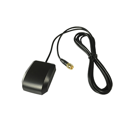
A gps antenna is a specialized device designed to receive signals from global positioning system (GPS) satellites. These antennas play a crucial role in providing accurate location and timing information by capturing the signals transmitted by gps satellites orbiting the Earth.

How gps antennas Receive Signals from GPS Satellites and Determine Position and Time
Global Positioning System (GPS) technology has revolutionized navigation and timing across various sectors, from everyday consumer devices to complex scientific applications. At the heart of this technology is the GPS antenna, a critical component that facilitates accurate location and time determination by receiving signals from GPS satellites. This article delves into the intricacies of how GPS antennas function, how they receive signals from GPS satellites, and how these signals are utilized to calculate precise location and time.
1. The Role of GPS Antennas
GPS antennas are designed to capture radio signals transmitted by a constellation of GPS satellites orbiting the Earth. These antennas are integral to the GPS system, as they translate weak satellite signals into usable data for navigation and timing applications.
Key Functions:
Signal Reception: The primary role of a GPS antenna is to receive signals from multiple GPS satellites. These signals are weak when they reach the Earth's surface, so the antenna’s sensitivity and design are crucial for effective signal capture.
Signal Amplification: Many GPS antennas are equipped with built-in amplifiers that boost the received signals to ensure they are strong enough for the GPS receiver to process.
Signal Filtering: GPS antennas often include filters to minimize interference from other radio frequency sources, improving signal clarity and accuracy.
2. How GPS Signals Are Transmitted
GPS satellites orbit the Earth in a highly coordinated manner, transmitting radio signals continuously. Each satellite broadcasts signals containing information about its location and the exact time the signal was sent.
Key Components of GPS Signals:
Carrier Waves: GPS signals are transmitted on specific carrier frequencies (L1, L2, L5). The most commonly used frequency for civilian GPS receivers is L1 at 1575.42 MHz.
Code Sequences: Each GPS satellite transmits a unique pseudo-random code (PRN code) that distinguishes its signal from others. This code is used to identify which satellite is sending the signal.
Navigation Data: In addition to the carrier wave and code, the signal contains navigation data that provides information about the satellite's position and the precise time the signal was sent.
3. The Signal Reception Process
When a GPS antenna receives a signal from a satellite, it undergoes several processing steps before being used to determine location and time.
Reception Steps:
Signal Capture: The GPS antenna captures the incoming radio signals from multiple satellites. The quality of the signal depends on the antenna’s design, its placement, and environmental factors.
Signal Amplification: The captured signals are often very weak. An onboard amplifier boosts the signal strength to make it more detectable by the GPS receiver.
Signal Filtering: Filters are used to remove noise and interference from other radio sources, ensuring that only the relevant GPS signals are processed.
Signal Processing: The filtered signals are then processed by the GPS receiver, which decodes the pseudo-random codes and navigation data to extract the timing information and satellite positions.
4. Calculating Position and Time
To determine precise location and time, the GPS receiver uses the information from at least four satellites. Here’s how it works:
Key Calculation Steps:
Time of Flight Calculation: The GPS receiver calculates the time it took for each signal to travel from the satellite to the receiver. This is done by comparing the time the signal was sent (as recorded in the navigation data) with the time it was received.
Distance Calculation: By multiplying the time of flight by the speed of light, the receiver determines the distance between itself and each satellite. This distance is called the pseudo-range.
Trilateration: Using the distances from at least four satellites, the GPS receiver performs a mathematical process called trilateration to calculate its exact position. Trilateration involves solving equations to find the intersection point of spheres centered around each satellite, with radii equal to the calculated distances.
Time Synchronization: To correct any discrepancies between the receiver’s internal clock and the GPS system time, the receiver uses data from the fourth satellite. This step ensures that the calculated position and time are accurate.
5. Factors Affecting GPS Accuracy
Several factors can affect the accuracy of GPS positioning:
Signal Blockage: Physical obstructions, such as buildings, mountains, or dense foliage, can block or weaken GPS signals, leading to reduced accuracy.
Atmospheric Conditions: Variations in the Earth's atmosphere, such as ionospheric and tropospheric delays, can affect signal propagation and accuracy.
Multipath Effects: Signals reflected off surfaces like buildings or water bodies can create multipath interference, impacting the accuracy of the GPS receiver.
Satellite Geometry: The arrangement of satellites in the sky affects the precision of the position calculation. A better spread of satellites leads to more accurate positioning.
6. Applications of GPS Technology
GPS technology, facilitated by antennas, has a wide range of applications:
Navigation: GPS is widely used in vehicles, aircraft, and maritime navigation to provide accurate positioning and route guidance.
Mapping and Surveying: GPS is essential for creating detailed maps and conducting land surveys with high precision.
Timing: GPS provides precise time synchronization for various applications, including telecommunications, financial transactions, and scientific research.
Emergency Services: GPS aids in locating individuals and vehicles during emergencies, improving response times and coordination.
GPS antennas are fundamental to the operation of the Global Positioning System, enabling accurate location and time determination by receiving and processing signals from GPS satellites. Through advanced signal reception, amplification, and processing techniques, GPS antennas ensure that users receive precise and reliable positioning information. Understanding the role and functionality of GPS antennas highlights their importance in various applications and underscores their impact on modern navigation and timing technologies.